 |
 |

Subject: Romney Marsh
Journal: The Times Date: August 1995 Author: Clive Fewins
The late John Piper, who loved to paint on Romney Marsh and wrote a book on these famous flatlands at the foot of
Kent, described the 100 square miles of Romney Marsh as “97 per cent atmosphere.”
His book on Romney Marsh was published in 1950, but walking and driving around the marsh today it is still easy
to see what he meant. There is a feeling of boundless space. The combination of the levels and the nearby sea
frequently brings skies of East Anglian proportions. Among the byways of the marsh (and there are many of them)
there is often a solemn stillness, a slight sense of eeriness, and a silence that is all too rare in the crowded
south-east of our country.
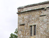
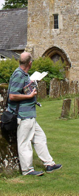
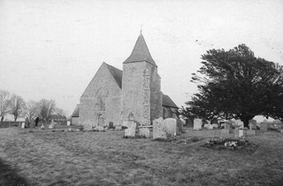 The church of St. Clement, Old Romney
Drive into any byroad from one of the two main roads that cross the marsh and even in the height of summer you
will soon avoid the boisterousness of the tourist beaches and the coastal candyfloss economy. In this world of
reed-filled dykes and innumerable other ditches, cuts, sluices, streams channels and pools the daytime peace is
disturbed only by the singing of the wind in the grass and the plaintive call of the lapwing. In the twilight the
mists creep out in most weathers to envelop the road that somehow manages to zigzag its way across the marshes to
get to any of the several dozen spartan hamlets, distinguished from a distance only by the sturdy spires and
occasional tower of their churches.
Reigning supreme over these innumerable channels is the 27 mile long Royal Military Canal, built in 1804-6 along
the northern edge of the marsh to keep out Napoleon, who was preparing a large invasion fleet off Boulogne. The
canal takes a deliberately zigzag route for defensive purposes and effectively turns Romney Marsh into an island,
was never tested. For reasons never fully understood in 1805 Napoleon ordered his 100,000 men to strike camp at
Boulogne and march to Austria. Since then, apart from during the Second World war, when it became bristling with
pillboxes, all has been peace. Today anglers line the zigzag course of the waterway and walkers take advantage of
the many scenic stretches of towpaths. The canal, which is lined with thick banks of daffodils and tulips in the
spring provides a valuable means of drainage for the levels.
The canal was intended as a second line of defence against Napoleon, the first being the line of Martello towers
(the name originated from a fort that the British had stormed with great difficulty at Mortella in Corsica.)
Originally 73 of these towers were built, stretching right round the coast from Folkestone to Seaford in West Sussex.
One of the towers, number 24, at Dymchurch, has been restored by English Heritage and is open to the public daily
during the summer.
Some of the towers are set beside the great sea wall that protects the land from inundation from the sea. For this,
not surprisingly is one of the most low-lying sections of the South-East, the greater part of Romney Marsh being
below sea level.
Nearly 20 miles of coast bound the area covered by the marsh. They contain one of the most remarkable beachlands in
the world, the bleak wastelands of Denge Beach, ending in the ever-growing promontory of Dungeness, said to be growing
at the rate of seven feet a year due to the constant scouring of shingle from the seabed by storm action.
In late March and April the headland and surrounding beaches are host to thousands of early migrants from North Africa
such as swallows, willow warblers, sand martins, wheatears, yellow wagtails, yellow ringed plover, chiffchaff and the
rare Sandwich tern.
But this is not the only shoreline of Romney Marsh. A few miles inland you will see a second – historic shoreline,
known as the Saxon shore and the mark of the line where the chalk cliffs once met the sea. A section of the Saxon
Shore Way, one of Kent’s long-distance footpaths, can be walked here, in one of the last sections of its 140-mile
journey from Gravesend to Rye. The path passes through the village of Appledore, described by many as the gateway to
the marsh. The village was formerly a prosperous port on the River Rother, which sits on high ground overlooking
the marsh.
One way to view the current shoreline is the take the Romney Hythe and Dymchurch Light Railway, which runs for
nearly 14 miles along ‘smugglers country’ just inland from the coast. The line links the three towns it takes its
name from with the fishermen’s cottages and lighthouses at Dungeness. It opened in 1927 and is the world’s only 15in.
gauge miniature main line. The miniature steam-powered trains are one-third full-size replicas of the giants of the
golden age of steam and carry up to 200 passengers at speeds approaching 25 miles an hour daily from 8th. April.
There is a weekend service throughout March.
And if that is not enough for oddities consider the fact that this is not just one marsh but five. Romney Marsh is
the name popularly given to all the levels between the rim of low hills and the sea from Hythe to Rye. Romney Marsh
proper is that part of the area which lies east of a line from Appledore to the small town of New Romney – roughly
half of the levels.
West of that line are the areas known as Denge Marsh, Walland Marsh, which includes the town of Lydd and also the
headland area of Denge Beach known as Dungeness, and East Guldeford Level, which lies to the west between the drain
known as the Kent Ditch and the picturesque small East Sussex town of Rye.
Rye is a good base from which to explore the western levels, home of some of the most interesting flora to be found
in the area. In springtime abundant blackthorn blossom adorns the hedgerows, phragmites, reed mace and yellow iris
are found in profusion in the dykes, and silvered leaf potentilla flowers by the roadside. Varieties of wild orchid
that have been found on the marsh include the early purple orchid, marsh helleborine, fragrant orchid, green winged
orchid and the pyramidal orchid.
Spring, especially the lambing month of April, is also a good time to view the great flocks of Romney Marsh sheep on
the rich fattening grounds of the East Guldeford Levels on the west side of the levels. Although in recent years much
of the prime farmland in the centre and east of the marsh has been given over the growing wheat, potatoes and oilseed
rape the sturdy Romney Marsh sheep, equally prized for their wool and their meat, are still the breed preferred by
local farmers.
Rapacious eyes from across the water have long viewed the areas these levels meet the sea as invasion beaches. Before
Napoleon, Roman, Saxon, Dane Norman cast an envious eye on the wide beaches and rich soils beyond. More recently Hitler
viewed this section of coast with keen interest. Hence the fact that the marsh is still host to two military firing
ranges and the remains of four wartime airfields.
In the more peaceful times since 1945 the keen interest of John Piper and others in the churches of the marsh led to
the formation of the Romney Marsh Historic Churches Trust. In these days of small congregations and combined benefices
presided over by an overworked parson the trust does valiant work aiding the congregations of the 14 medieval churches
on the marsh to maintain their church buildings.
The marsh churches are remarkable first and foremost because they can be seen so readily across the flat fields, looking
so big in proportion to the tiny settlements they occupy under the expansive skies. Among them are gems like St.
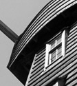
Augustine’s, Brookland, with its 13th. century wooden octagonal belfry standing at ground level beside the church, St.
Clement’s, Old Romney, with its two hagioscopes, or ‘holy peepholes’ and unaltered Georgian interior, and St. Nicholas,
New Romney, with its magnificent Norman tower.
The atmosphere of the marsh, which John Piper set out so keenly to capture, is nowhere better exemplified than in the
tiny church of St. Thomas a Becket, Fairfield, isolated in fields near a minor road two miles south of Appledore and
approached via a causeway through fields that often flood in winter.
|
|||||||
| © 2006–2026 Clive Fewins. All rights reserved. | Site designed by Ridgedale Communications Ltd. | |||||||||||||||||||||
